


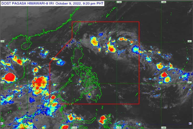
MANILA — The Philippine Atmospheric, Geophysical and Astronomical Services Administration (PAGASA) on Sunday stated that two low-pressure areas in the Pacific Ocean are now moving toward the country.
Last Saturday, one of the weather disturbances entered the Philippine area of responsibility and was last spotted about 1,300 kilometers east of Central Luzon.
According to PAGASA, the LPA is moving westward and may bring rains and rough seas to Northern and Central Luzon as early as today and may develop into a typhoon before making landfall.
The other LPA was last observed more than 2,000 kilometers east of Visayas, indicating that it may enter Philippine area on Thursday or Friday.
PAGASA stated that the LPA is still too far away to anticipate or track its trajectory, but it is constantly being watched as it approaches the country.
The state weather bureau said that for the next three days, Metro Manila is expected to have fair weather conditions with isolated light rains and low chances of rain tomorrow and on Wednesday.
Due to the approaching LPA and northeasterly windflow, the Cordillera Administrative Region, including Baguio City, will have higher chances of rain.
The Bicol region is also expected to have fair weather, with the possibility of rain tomorrow and Wednesday afternoon due to localized thunderstorms.
In the next three days, the Visayas is forecast to have partly cloudy to cloudy skies with chances of rain in the early morning, while Mindanao will have better, but hot and humid weather with temperature reaching 33 degrees Celsius with a chance of light and quick rainfall.

4 Replies to “2 LPAs near PH”