


MANILA — A low-pressure area has developed into a tropical cyclone and intensified into a tropical storm that can reach typhoon category, which will also enhance the southwest monsoon, the Philippine Atmospheric, Geophysical and Astronomical Services Administration (PAGASA) said yesterday.
PAGASA weather specialist Loriedin de la Cruz-Galicia said that as of 5 p.m. yesterday, Tropical Storm Goring further intensified while moving slowly northwestward over the Philippine Sea east of Basco, Batanes.
Galicia said that the center of Goring was located at 265 kilometers east of Basco, with maximum sustained winds of 75 kms per hour near the center and gustiness of up to 90 kph as it is moving northwestward at 10 kph.
Galicia said that Goring is the seventh cyclone to enter the Philippine area of responsibility (PAR) in 2023.
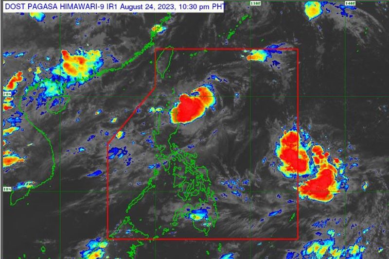
“Goring is moving slowly and aside from this, the southwest monsoon continues to affect many areas in the country. Based on the satellite images, the rains are concentrated in the western section of Luzon and other parts of the Visayas,” Galicia said.
Galicia added that in the next 24 hours, Goring is expected to be located 250 kms east southeast of Basco.
“On the other hand, in the next 48 hours or two days from now, it is expected to intensify into a severe tropical storm and its center will be located 315 kilometers east of Aparri, Cagayan. In the next three days, there is a big possibility that its center will be 320 kilometers east of Tuguegarao City, Cagayan as a typhoon,” Galicia said.
According to Galicia, Goring will be located 535 kilometers east of Tuguegarao City in the next 96 hours.
“It will remain steady at the Philippine Sea,” Galicia said, adding, “It is possible that we will raise a tropical cyclone wind signal starting tonight or tomorrow in Northern Luzon.” She said that due to the proximity of Goring, it would cause heavy rainfall over portions of Cagayan Valley in the next three days.
“Goring will also enhance the southwest monsoon starting Sunday or Monday. It will bring rains over portions of Central and Southern Luzon,” Galicia explained, adding that rains will be concentrated in Cagayan Valley region, Cordillera Administrative Region (CAR) and portions of Central Luzon.
“By Sunday, the rains will be concentrated in the Cagayan Valley Region. Strong rains are also expected in Zambales, Bataan, Metro Manila, Cavite, Batangas and Occidental Mindoro due to enhanced southwest monsoon due to the presence of Goring,” she said.
For his part, PAGASA deputy administrator for Operations and Services Bonifacio Pajuelas said another tropical cyclone will enter PAR before the end of August.
Preparations
Social Welfare Secretary Rex Gatchalian on Thursday instructed officials of the Department of Social Welfare and Development in Cagayan Valley and Southern Tagalog to prepare for the reported incoming Typhoon Goring.
“Please ensure preparedness on your respective AOR (areas of responsibility) in lieu of tropical depression Goring,” the DSWD chief instructed the regional directors of field offices 2 (Cagayan Valley) and 4-A (Calabarzon or Cavite-Laguna-Batangas-Rizal and Quezon).
The local DSWD officials, through the concerned regional offices through the Disaster Response and Management Group, were ordered to make an inventory of their relief goods in preparation for tropical depression.
Regional directors were also directed to check on their respective stockpile of family food packs to ensure ample supply for families and individuals who will be affected by Goring. (philstar)

phonk drift
Very good post! We are linking to this particularly great content on our website.
Keep up the good writing.
When some one searches for his essential thing, so
he/she wishes to be available that in detail, therefore that
thing is maintained over here.
Hello just wanted to give you a quick heads up.
The words in your post seem to be running off the screen in Ie.
I’m not sure if this is a format issue or
something to do with internet browser compatibility but I figured I’d
post to let you know. The style and design look great though!
Hope you get the problem solved soon. Kudos
Thanks for one’s marvelous posting! I certainly enjoyed reading it, you could be a great author.I will be sure to
bookmark your blog and definitely will come back at some point.
I want to encourage you continue your great work, have a nice afternoon!
Heya i am for the first time here. I came across this board
and I in finding It really useful & it helped
me out much. I’m hoping to present one thing back and help others such as you helped me.
great submit, very informative. I ponder why the other experts of this sector do not notice this.
You should proceed your writing. I am sure, you have a great readers’
base already!
Excellent article. Keep writing such kind of info on your blog.
Im really impressed by your site.
Hello there, You’ve done a great job. I will definitely digg it and in my view recommend to my
friends. I’m confident they will be benefited from this website.
This design is wicked! You obviously know how to keep a reader amused.
Between your wit and your videos, I was almost moved to start my own blog (well, almost…HaHa!) Excellent job.
I really enjoyed what you had to say, and more
than that, how you presented it. Too cool!
Pretty nice post. I just stumbled upon your weblog and wished to say that I have
truly enjoyed surfing around your blog posts.
In any case I will be subscribing to your feed and I hope you write again very soon!