


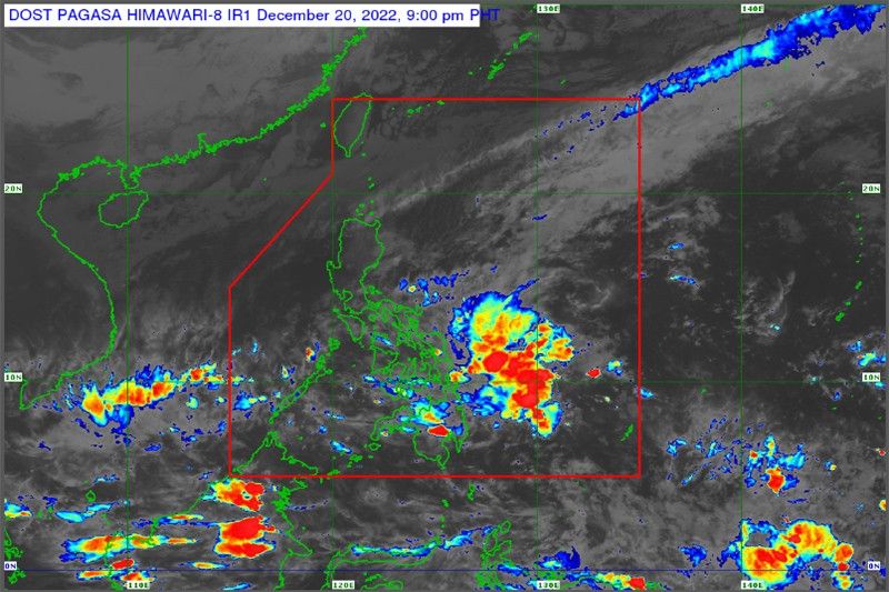
MANILA — The Philippine Atmospheric, Geophysical and Astronomical Services Administration (PAGASA) stated that a low-pressure area entered the Philippine area of responsibility off the coast of Mindanao on Tuesday, and will bring rains as it moves closer to the landmass.
According to the weather bureau, the low-pressure area was monitored 275 kilometers east of General Santos City as of 3 p.m. yesterday.
There is a low possibility that the low-pressure area will become a tropical cyclone as it remains almost stationary, but could move closer to Mindanao.
The low-pressure area and the shearline are bringing cloudy skies with scattered rainshowers over the Bicol Region, Eastern Visayas, Central Visayas, Caraga and the Davao Region.
Meanwhile, cloudy skies with rains are expected over Metro Manila, Cagayan Valley, Cordillera Administrative Region, Aurora, CALABARZON, Oriental Mindoro and Marinduque due to the northeast monsoon.
Due to the low-pressure area trough and localized thunderstorms, the rest of the country will experience isolated rainshowers.
Flashfloods and landslides are likely during at times heavy rains, according to PAGASA.

промокод для 1xbet. Click Here:👉 http://www.newlcn.com/pages/news/promo_kod_1xbet_na_segodnya_pri_registracii.html
мелбет промокоды Click Here:👉 https://bit.ly/3YSgux0