


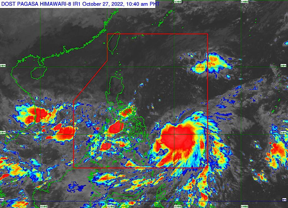
MANILA – The weather bureau on Thursday stated that tropical cyclone Paeng has intensified into a tropical storm, with maximum sustained winds of 65 kph near the center, and gustiness of up to 80 kph.
Tropical Cyclone Wind Signal No. 1 has been raised over Catanduanes, the eastern portion of Albay (Rapu-Rapu), and the eastern portion of Sorsogon (Prieto Diaz, Gubat, Barcelona, Bulusan, Santa Magdalena, Irosin, Juban, Casiguran, City of Sorsogon) Eastern Samar, Northern Samar, and Samar.
These areas will experience strong winds.
Paeng was last seen 540 km. east of Borongan, Eastern Samar, moving west southwestward at 10 kph.
According to the Philippine Atmospheric, Geophysical and Astronomical Services Administration (PAGASA), further intensification is possible while Paeng is moving over the warm waters of the Philippine Sea.
Paeng could become a severe tropical storm within 24 hours.
The trough of Paeng and the shear line will continue to cause heavy rains over the Visayas, most of Southern Luzon, and the northern part of Mindanao.
The surge of the northeast monsoon will also bring strong winds with gusts reaching gale-force strength over the Bicol Region, Batanes, Babuyan Islands, Quezon, Marinduque, Romblon, and the northern portion of mainland Cagayan, Apayao, and Ilocos Norte in the next 24 hours.
Rough to extremely rough seas persisted along the coasts of Northern Luzon, the eastern coast of Central Luzon, the eastern coast of Southern Luzon and the Visayas.
Larger sea vessels are warned against big waves, while fishing boats and other small seacraft are still advised not to venture into the sea.

8 Replies to “Paeng intensifies into a tropical storm”