


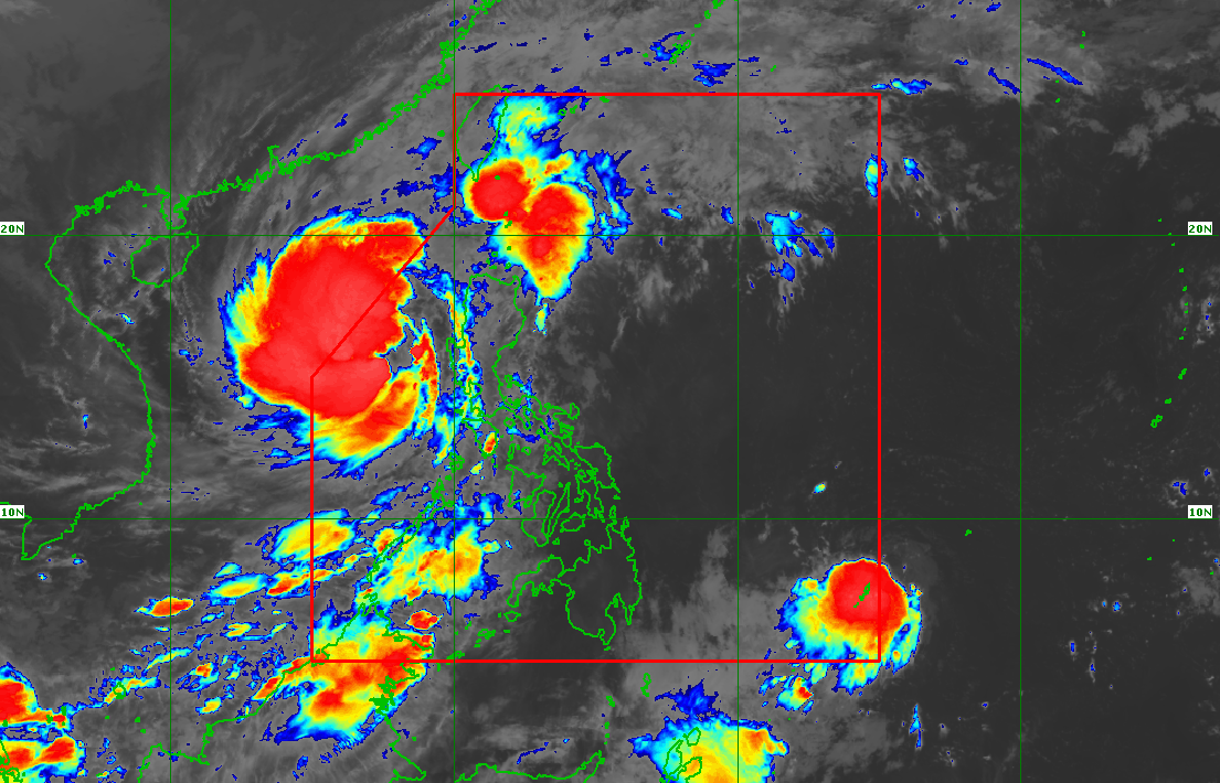
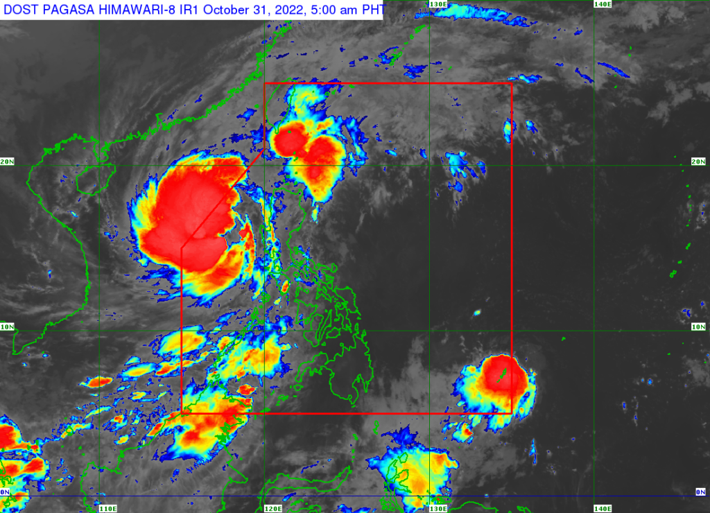
MANILA – The Philippine Atmospheric Geophysical and Astronomical Services Administration (PAGASA) announced that tropical storm Paeng (international name: Nalgae) is anticipated to exit the Philippine Area of Responsibility (PAR) this afternoon or evening while Tropical Depression Queenie entered PAR at 5 a.m. on Monday, October 31.
According to its latest bulletin, PAGASA said that Paeng is moving towards the northwestern limit of PAR. Paeng was last spotted 320 kilometers (km) West Northwest of Iba, Zambales or 340 km West of Dagupan City, Pangasinan. Paeng packs maximum sustained winds of 85 kilometers per hour (kph) near the center with gustiness of up to 105 kph and is moving west northwestward at 10 kph.
Tropical Cyclone Wind Signal No. 1 is still raised in the following areas in Luzon: Ilocos Norte, Ilocos Sur, La Union, Pangasinan, Apayao, Kalinga, Abra, Mountain Province, Ifugao, Benguet, Nueva Vizcaya, the western portion of Cagayan (Santa Praxedes, Claveria, Sanchez-Mira, Pamplona, Abulug, Ballesteros, Allacapan, Lasam, Santo Niño, Piat, Tuao, Rizal), the western portion of Isabela (Cordon, City of Santiago, San Mateo, Ramon, Alicia, San Isidro, Quezon, Mallig, Roxas, San Manuel, Aurora, Cabatuan), the northwestern portion of Quirino (Cabarroguis, Diffun, Saguday), the northern, western, and southern portions of Nueva Ecija (Cuyapo, City of Gapan, Talavera, San Leonardo, Santo Domingo, Rizal, San Isidro, Zaragoza, Llanera, Guimba, Aliaga, Science City of Muñoz, General Mamerto Natividad, Cabanatuan City, Carranglan, Quezon, San Antonio, San Jose City, Santa Rosa, Lupao, Nampicuan, Talugtug, Peñaranda, Jaen, Licab, Cabiao, Pantabangan), Pampanga, Bataan, Tarlac, Zambales, and the western portion of Bulacan (Hagonoy, Paombong, City of Malolos, Guiguinto, Calumpit, Pulilan, Plaridel, Baliuag, Bustos, San Miguel, San Ildefonso, San Rafael).
“Re-intensification into a severe tropical storm category remains likely within 12 to 24 hours. However, a weakening trend is expected by late Wednesday or on Thursday,” the state weather bureau said.
PAGASA stated that moderate to heavy rains remains possible over Batanes, Zambales, Bataan, Occidental Mindoro, and Palawan including Calamian and Cuyo Islands. Light to moderate with at times heavy rains still possible over Ilocos Region, Cordillera Administrative Region, Metro Manila, CALABARZON, Western Visayas, Babuyan Islands, the rest of Central Luzon and MIMAROPA.
A marine gale warning remains in effect over most seaboards of Luzon due to the surge of the Northeast Monsoon and Paeng.

👉 FREE EXCHANGE BONUSES BELOW 👉 PlaseFuture FREE BONUS 👉 PROMOCODE FOR NEWS USERS OF THE EXCHANGE 👉 [YLPUJYWJPN] — 0.01 BTC 👉 site: https://mixcoinexpro.com Our site is a secure platform that makes it easy to buy, sell, and store cryptocurrency like Bitcoin, Ethereum, and More. We are available in over 30 countries worldwide.