


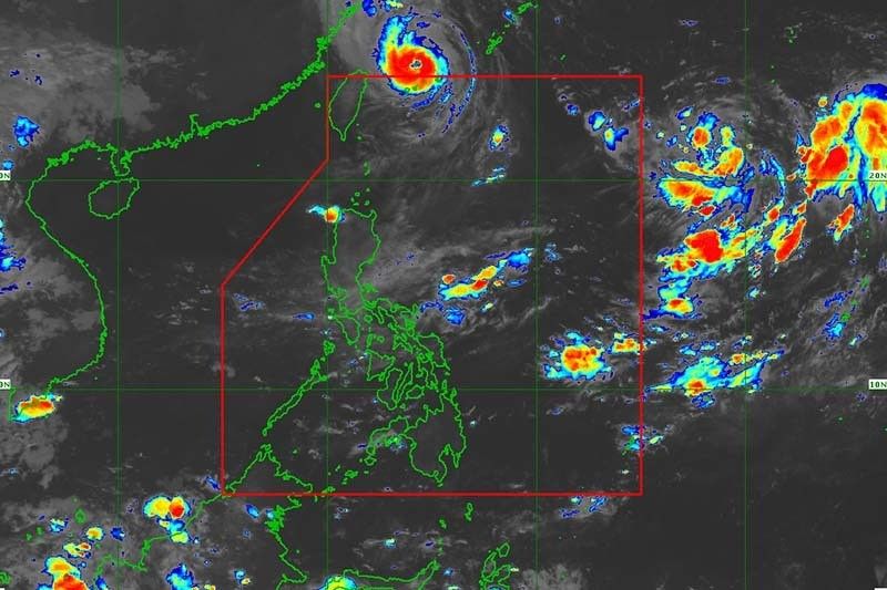
MANILA — The state weather bureau stated that the tropical depression outside the Philippine Area of Responsibility may enter the country’s jurisdiction on Thursday.
PAGASA said in a bulletin issued around 5 a.m. that the cyclone was spotted 1,720 kilometers east of Extreme Northern Luzon.
The tropical depression had peak winds of 45 kph near the center and gusts of up to 55 kph. It was slowly going east.
The weather forecaster stated that the cyclone may enter the PAR region Thursday afternoon or evening. Once inside PAR, it will be called “Josie”.
“Modest intensification is likely today through tomorrow. By Thursday, improving environmental conditions will enable the tropical cyclone to intensify at a relatively faster rate,” PAGASA said, adding the cyclone may enter PAR as a typhoon.
It is anticipated to remain far from the Philippine landmass and not directly affect the country’s weather condition.
It may, however, intensify rains over the western parts of Southern Luzon and Visayas starting Wednesday or Thursday.
Inday exits PAR
At 12:40 a.m., Typhoon Inday (Muifa) departed PAR.
According to PAGASA, it is “unlikely to directly bring heavy rains in the country.”
As a result of the channeling of the typhoon circulation in the Luzon Strait, gusty conditions reaching strong to gale-force strength will continue to affect Extreme Northern Luzon.
Due to the effects of Inday, a gale warning remains in place for the seaboards of Batanes and Babuyan Islands.

Hi there, just became alert to your blog through Google, and found that it’s really informative.
I’m going to watch out for brussels. I will appreciate if you continue this in future.
Many people will be benefited from your writing. Cheers!