


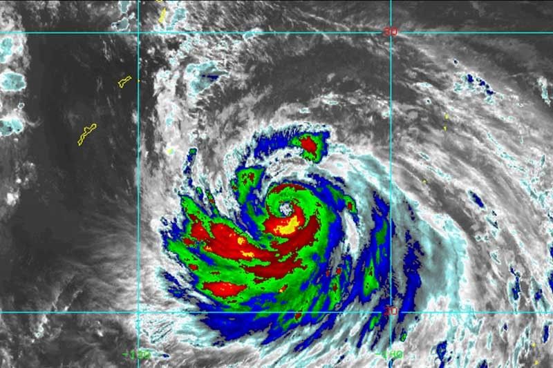
MANILA — State weather bureau PAGASA said Typhoon Nanmadol may enter the Philippine Area of Responsibility around Friday noon but it would have no direct impact on the country.
Nanmadol was last spotted 1,530 kilometers east of northeast of Extreme Northern Luzon with peak winds of 140 kph near the center and gusts of up to 170 kph.
Heading west at 15 kph, weather specialist Benison Estareja said the typhoon is expected to enter PAR around noon. Once it enters the country’s jurisdiction, it will be called “Josie”.
Nanmadol will not have any direct effects on the country because it is expected to remain far from the country’s landmass. It is also anticipated to leave PAR Friday evening.
However, the typhoon is enhancing the southwest monsoon or habagat. The southwest monsoon is affecting Southern Luzon, Visayas, and the western section of Mindanao, according to PAGASA.
The southwest monsoon will bring cloudy skies with scattered rain showers and thunderstorms to residents of MIMAROPA, Bicol region, and Western Visayas.
Over Metro Manila and the rest of the country, the southwest monsoon will also bring partly cloudy to cloudy skies with isolated rain showers or thunderstorms.

relaxing october jazz
I like the helpful info you supply for your articles.
I will bookmark your blog and test once more right here regularly.
I’m slightly certain I’ll be told a lot of new stuff right right here!
Good luck for the following!